UAV Mapping for Applied Scene and Site Documentation
Overview
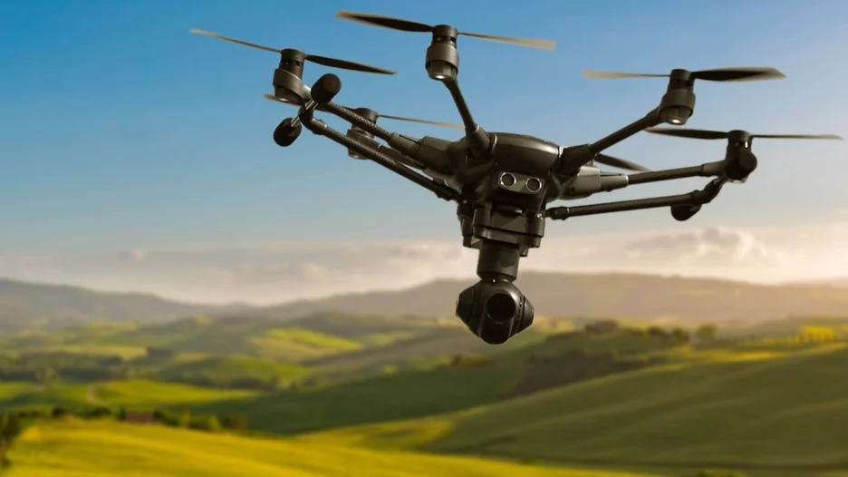
This micro-credential provides practical, hands-on training in the use of Remotely Piloted Aircraft Systems (RPAS), commonly known as UAVs or drones, for professional scene and site documentation.
Through self-paced online learning and a full day of hands-on flight training, learners will develop the knowledge and practical skills needed to safely plan and conduct RPAS documentation missions. The course covers pre-flight preparation, mission planning, regulatory and safety considerations, flight operations, and image capture for 2D photomapping and 3D digital modelling.
Designed for forensic investigators and other professionals involved in scene or site documentation, the course also supports professionals who currently use or are considering RPAS for mapping, inspection, and documentation in their field.
The course concludes with a scenario-based practical field assessment, allowing learners to demonstrate their ability to plan, safely conduct, and document an RPAS mission.
Who should attend
This program is ideal for:
- Forensic investigators and professionals involved in outdoor scene and site documentation.
- Police Forensic Identification specialists.
- Collision Reconstruction specialists.
- Investigators and professionals working with:
- Ontario Fire Marshal’s Office (OFM)
- Special Investigations Unit (SIU)
- Ministry of Labour (MOL)
- Ministry of Transportation (MTO)
- Ministry of Natural Resources (MNR)
- Technical Standards and Safety Authority (TSSA)
- Municipal public works, engineering, and asset management professionals.
- Construction and civil engineering teams.
- Environmental consultants and conservation authorities.
- Insurance adjusters and loss investigators.
- Utilities and energy-sector field teams.
- Emergency management professionals.
- Professionals in related fields who:
- Currently use Remotely Piloted Aircraft Systems (RPAS) for mapping, inspection, or scene and site documentation.
- Are considering adopting RPAS for mapping, inspection, or scene and site documentation.
Learning Outcomes
By the end of this micro-credential, learners will be able to…
- Assess equipment, airspace, weather, environmental, and site-specific factors to identify constraints affecting an RPAS documentation mission.
- Plan an RPAS documentation mission aligned with the documentation objective, including flight path, altitude, camera orientation, coverage, and launch/recovery considerations.
- Perform basic and intermediate flight operations while maintaining aircraft orientation, situational awareness and controlled camera positioning.
- Capture still and video imagery suitable for 2D photomapping and 3D digital modelling.
- Evaluate the suitability, limitations and anticipated outputs of the imagery collected for scene/site modelling.
Course information
Spring 2027
| Registration fee | Registration status |
|---|---|
| $499 CAD + HST (regular price) |
|
Discounts
The Alumni/Staff Discount applies to registration in this program/course.
If you are alumni or staff, contact continuouslearning@ontariotechu.ca with your Student/Banner ID before registering for details about how to apply this discount.
Registration
You can register for this course through the secure online registration form. All course fees must be paid at the time of registration.
Part 1: Asynchronous Pre-Learning on Canvas
Learners will complete four self-paced modules on Canvas prior to attending the in-person training session.
| Module | Module Name | Estimated Learner Engagement Time |
|---|---|---|
| Module 1 | Pre-Flight Preparation | 1.5 hours |
| Module 2 | Mission Scope and Planning | 1.5 hours |
| Module 3 | Safety and Environmental Considerations | 1.5 hours |
| Module 4 | Image Capture Principles and Applications | 1.5 hours |
| Total | 6 hours |
Part 2: Synchronous In-Person Training (Date: May 7)
Learners will participate in instructor-led, hands-on training to apply the knowledge and skills developed during the asynchronous pre-learning modules.
| Session | Time | Session Name |
|---|---|---|
| Introduction & Overview | 8:00–8:15 a.m. | Course Introduction and Overview |
| Session 1 | 8:15–10:15 a.m. | Basic Flight Operations |
| Break | 10:15–10:30 a.m. | Break |
| Session 2 | 10:30 a.m.–12:00 p.m. | Intermediate Flight Operations |
| Lunch Break | 12:00–1:00 p.m. | Lunch |
| Session 3 | 1:00–3:00 p.m. | Image Capture |
| Break | 3:00–3:15 p.m. | Break |
| Session 4 | 3:15–4:45 p.m. | Applications, Equipment Considerations and Course Debrief |
This is an open enrolment offering.
Those completing Ontario Tech University Continuous Learning open enrolment offerings (e.g. certificate programs, courses, workshops, microcertifications, etc.) are subject to the policies of Ontario Tech University and Continuous Learning. Ontario Tech policies can be found in the Policy library. Continuous Learning policies can be found in the Regulations section of the Continuous Learning website. Specifically, those completing open enrolment offerings are expected to adhere to the General and Open enrolment regulations.
Ontario Tech University – Continuous Learning assigns Continuing Education Units (CEUs) to eligible offerings. CEUs are awarded under the Ontario Tech University – Continuous Learning (CL) Framework for Awarding Continuing Education Units (CEUs) and Professional Development Hours Reference Standards.
CEUs are provided to support professional development reporting. They do not constitute accreditation or certification by an external licensing or regulatory body. Recognition and acceptance of CEUs are determined solely by the policies of individual employers, professional associations, or professional regulatory organizations.
Requirements
While open to professionals across a range of fields, this course is designed primarily for forensic investigators and other professionals responsible for documenting outdoor scenes and sites. In Ontario, this may include Police Forensic Identification and Collision Reconstruction specialists, as well as investigators with organizations such as the Ontario Fire Marshal’s Office (OFM), Special Investigations Unit (SIU), Ministry of Labour (MOL), Ministry of Transportation (MTO), Ministry of Natural Resources (MNR), and Technical Standards and Safety Authority (TSSA), among others.
The program may also be valuable to professionals in related fields who currently use, or are considering using, Remotely Piloted Aircraft Systems (RPAS) for scene and site documentation, mapping, inspection, or other professional applications.
To successfully complete the course, you must:
- Register and make full payment for the course;
- Successfully complete both components of the program: Asynchronous Online Learning (approximately 6–8 hours) and a 1-Day In-Person Training Session.
Participants will receive a Level 1 micro-credential badge upon successful completion of each micro-credential.
Technology requirements
Online learning requirements:
- Computer or device with internet access
- Stable internet or data connection
- Audio device (examples: speakers, headphones/earbuds, headset)
Material requirements
There are no additional materials required.
A micro-credential is a digitally-recorded recognition of a specific skill. It is a portable communication tool that represents evidence of your skills for employers, educators, and peers. Micro-credentials are created with industry, so you can be assured that the skills you are learning are in demand and current.
Participants who successfully complete this micro-credential will be able to:
- Plan and safely conduct a basic RPAS documentation mission for an outdoor scene or site.
- Demonstrate controlled and safe RPAS flight.
- Select appropriate image-capture settings for 2D photomapping.
- Select appropriate image-capture settings for 3D digital modelling.
- Evaluate whether the resulting imagery is sufficient for the intended documentation purpose.
- Recognize operational, environmental, and technical limitations that may affect RPAS missions.
Learn more about micro-credentials and digital badges on the Learning Innovation website.